Detection methods
Cameras, satellites and sensors: how wildfire detection methods compare
A view of the hillside, a scan from space or a measurement near the ground. Each approach offers useful evidence, with different gaps to understand.
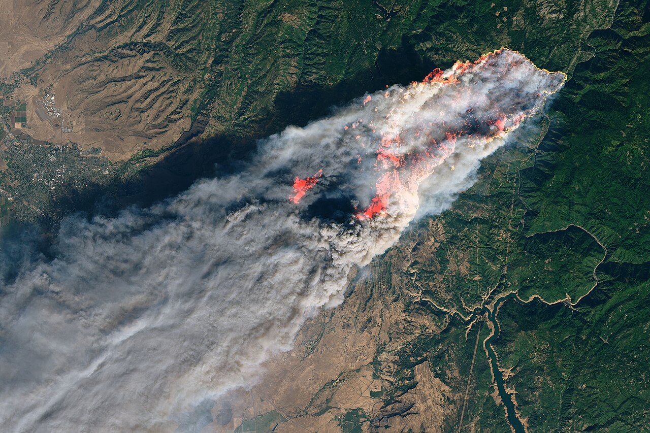

A camera can show a smoke plume. A satellite can identify heat across a large region. A ground sensor can register changes in the air nearby. These different ways of detecting wildfire offer different clues, and each has gaps.
For a landowner or site manager, the useful question is what information a system can provide at the places that matter. Start with the landscape, the risks and the people who will act on an alert.
The methods at a glance
| Method | What it adds | What can limit it |
|---|---|---|
| Cameras | Repeated views and images that people can review. | Obstructed views, confusing visual signals and feed availability. |
| Satellites | Coverage across large areas, including remote terrain. | Cloud, observation gaps, image detail and data delivery time. |
| Ground sensors | Local measurements without needing a clear camera view. | Placement, wind, network density, power and maintenance. |
A general comparison based on the sources below. Performance depends on the equipment, installation and conditions.
Cameras: a view people can review
Cameras let operators revisit the same landscape and inspect a suspected plume. Software can flag images for attention, as our guide to how AI detects wildfire smoke explains.
An operational account from the HPWREN camera network describes the value of short image sequences for checking whether a signal is smoke. Multiple viewpoints can also help narrow down a fire’s location. One view may show a direction without establishing the distance.
The same account identifies fog, haze, glare and cloud formations as sources of false alerts. A ridge or other natural barrier can hide a fire. Ask what the proposed camera can detect by day and after dark, and how it reports a lost connection. Our existing-camera assessment guide covers these practical checks.
For a closer look at range and blind spots, read what determines a fire camera’s coverage.
Satellites: the wider picture
Satellites can reveal fire activity far beyond a single site. Many fire products identify unusually hot areas using infrared observations. Their usefulness depends on the instrument, its orbit and how quickly processed information becomes available.
Polar-orbiting satellites pass over an area at intervals. Geostationary satellites stay above the same region and observe it frequently. For example, NOAA’s GOES Advanced Baseline Imager can image the US mainland every five minutes. That is an observation interval, not a promise that every fire will trigger an alert within five minutes.
Image detail needs care too. NASA’s FIRMS guidance describes a commonly used VIIRS fire product with pixels approximately 375 metres across. A detected fire can occupy only part of a pixel. The pixel size is neither the fire’s measured size nor a minimum fire width required for detection.
Cloud, dense smoke or tree cover can hide fire activity, and some fires occur between observations. An empty satellite map therefore cannot establish that an area is fire-free. Check both the observation time and when the data reached you.
Ground sensors: measurements close to the risk
Here, ground sensors means devices that measure local conditions such as temperature, particles or gases. GAO describes networks that look for changes associated with fire. Smoke sensors can operate in poor visibility, but they depend on conditions where they are installed.
Placement and wind matter: a gas or particle sensor needs the relevant material to reach it. A 2026 DHS audit of one sensor programme found inconsistent detection, with wind speed and direction among the factors affecting performance. The finding underlines the need for evidence from field trials of the proposed system.
GAO also notes that some sensors need calibration and dense networks. Ask how the supplier established sensor spacing, how devices communicate and who maintains them. Coverage claims need evidence from comparable terrain and conditions.
Choose around the gaps at your site
Begin with a map of likely ignition areas and the places where early information would help. Mark camera blind spots, available power and communications, then ask suppliers to explain the remaining gaps.
Compare the complete service: equipment, installation, connectivity, maintenance and the work of reviewing alerts. Request evidence of missed detections, false alerts and notification times under stated conditions. A single advertised range or speed cannot answer all of those questions.
Combining methods may provide complementary evidence. A local measurement might prompt a camera check; satellite observations might add regional context. Treat these as possibilities to test with your team. As our article on why the first few minutes matter explains, useful detection also needs a clear route to response.
Sources & further reading
- Wildfire Management: Technologies for Forecasting, Detection, Mitigation, and Response US Government Accountability Office (2025)
- Lessons learned from operating a public wildfire detection system Kinshuk Govil, Open Climate Tech; published by HPWREN (2021)
- FIRMS frequently asked questions NASA Earthdata
- Advanced Baseline Imager (ABI) NOAA National Environmental Satellite, Data, and Information Service
- DHS Wildfire Sensors Did Not Consistently Detect Fires and Provide Early Warning DHS Office of Inspector General (2026), via Oversight.gov
NuraGaze provides wildfire early-warning software and monitoring systems. This explainer compares general approaches; it is not a performance test of individual products.